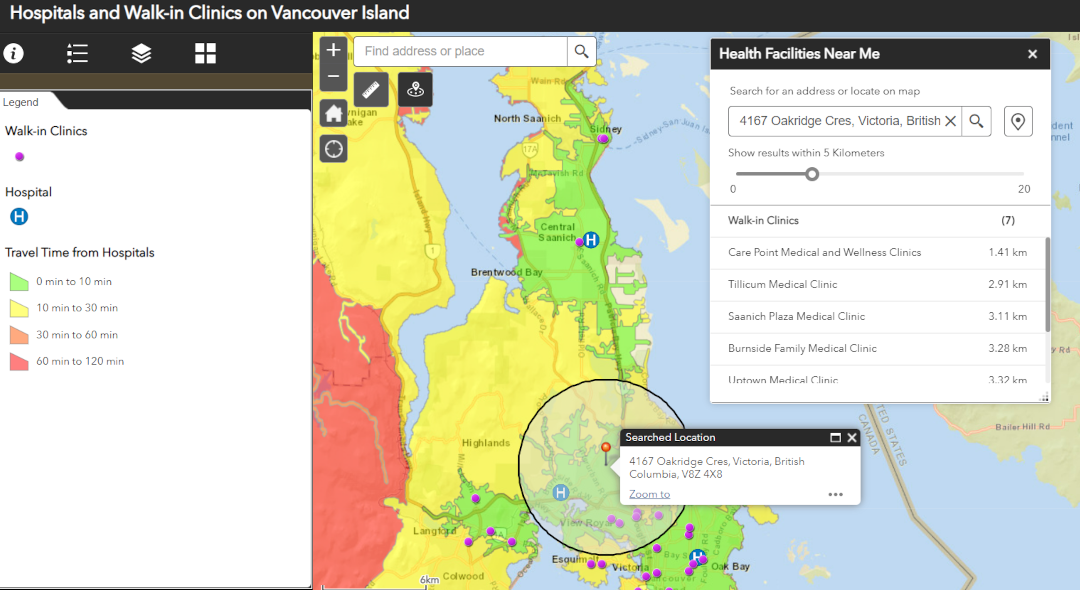
This ArcGIS Online app (built using Web AppBuilder) shows drive-times to hospitals on Vancouver Island, BC, Canada. The feature layer was created using the Create Drive-time Areas analysis tool.
The Create Drive-Time Areas tool uses Esri Service Areas to calculate the area that can be reached within a specified travel time or travel distance along a street network based on travel mode.
(Esri, n.d.)
The app was further customized using the Near Me widget to allow users to search for health care facilities (e.g., walk-in clinics and hospitals) near a specified location. The Near Me widget works by finding features within a given buffer distance of a defined address/location; the widget then shows the user a list of features (Esri, n.d.). It can even provide directions on how to navigate to a selected feature!
Please note: This drive-time app is intended to demonstrate GIS concepts and tools, it should not be used for actual navigation or health purposes. Drive times displayed in the app were estimated using the ArcGIS Online analysis widget, and do not consider live traffic. As of 2022-12-29, the Create Drive-time Areas tool is not yet available in the new Map Viewer (however, it is still available in Map Viewer Classic).
References
- Esri. (n.d.). Create Drive-Time Areas. Retrieved December 29, 2022, from doc.arcgis.com: https://doc.arcgis.com/en/arcgis-online/analyze/create-drive-time-areas.htm
- Esri. (n.d.). Near Me widget. Retrieved December 29, 2022, from doc.arcgis.com: https://doc.arcgis.com/en/web-appbuilder/latest/create-apps/widget-near-me.htm
Additional resources
- Create drive-time areas in ArcGIS Online
- How to configure the Near Me widget
- Learn about ArcGIS Web AppBuilder


Average Rating